
Tour review · MIAMI BOAT TOURS & CRUISES
Miami Cityscape Boat Tour – Waterfront Views on Biscayne Bay
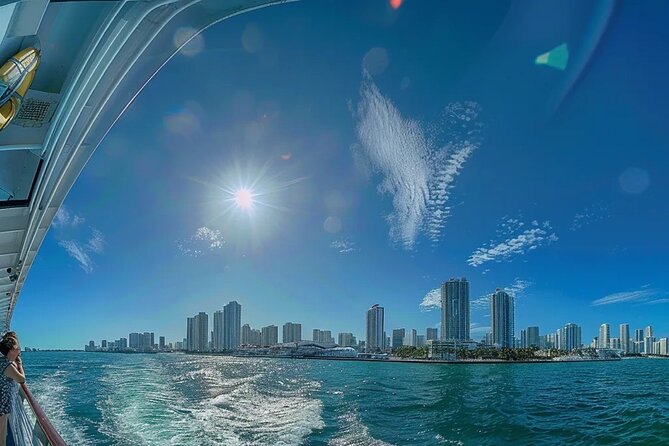
Biscayne Bay tells Miami’s story. This 90-minute boat tour from Bayside Marketplace gives you a smooth, low-stress way to read the city from the water, with Downtown skyline views as your anchor.
I love that the trip feels family-friendly and easy to enjoy, with an organized, comfortable flow. I also like the narration style, which turns the scenery into a quick Miami story, from the port to the islands.
One thing to consider: if you dislike a bit of tip pressure, go in ready with a decision in mind.
Key Highlights You Will Notice
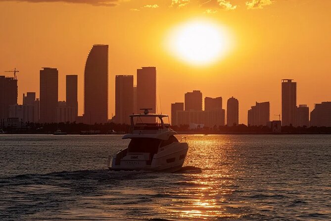
- Downtown skyline angles that look different than any street view
- Port of Miami views of cruise ships getting ready to depart
- Man-made island neighborhoods and causeways that explain Miami’s growth
- Henry Flagler’s memorial island and its big obelisk landmark
- Celebrity-address scenery along Star Island, Fisher Island, and nearby waters
More ways to see Miami from the water
- Miami: Biscayne Bay Millionaire’s Homes Sightseeing Cruise★ 4.5 · 7,348 reviews
- Miami: Hop-on Hop-off Open-top Bus Tour and Optional Cruise★ 4.1 · 3,077 reviews
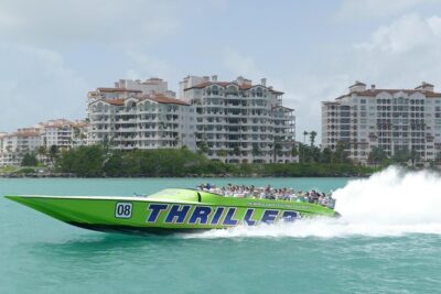
- Speedboat Sightseeing Adventure of Miami★ 4.5 · 3,025 reviews
- 2 hrs Miami Private Boat Tour with Cooler, Ice, Bluetooth Stereo★ 5.0 · 2,968 reviews
Why This 90-Minute Biscayne Bay Cruise Feels Like a City Orientation
Miami can be a lot on day one. Traffic, hot sidewalks, crowds, and “where do I even start?” questions. This boat tour keeps it simple. You get a focused run along Biscayne Bay where the skyline, the port, and the famous neighborhoods show up in a logical order.
At 90 minutes, it is long enough to feel like a real tour, but not so long that you are cooked by the heat. I like that it is also family-friendly, so you can bring kids without the trip turning into a history seminar you did not ask for.
The narration matters here. You are not just looking at buildings and houses. You are getting context, like how the city grew, why these islands exist, and how the bay became part of Miami’s identity.
Getting To Bayside Marketplace: Pier 5, Slips 21-23
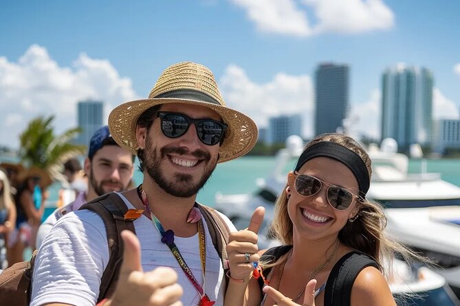
Your start point is Miami’s Bayside Marketplace, at 401 Biscayne Blvd, Miami, FL 33132. When you arrive, head toward Pier 5, and then look for Slips 21-23, which are located behind the Victoria Secret.
Check in at the Bayride Tours window on the north side of the pier. If you are using a phone for everything, good news: the tour uses a mobile ticket, so you are not hunting for a paper printout.
If you want the calmest start, give yourself a little extra time at Bayside. The meeting spot is straightforward, but once you are there, you still need to find your slip and get seated before boarding.
Port of Miami First Look: Cruise Ships and the Busy Passenger Side
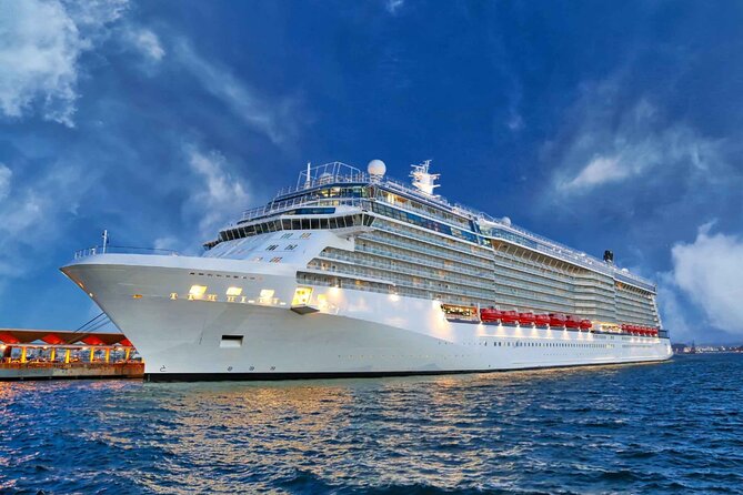
The tour begins with a stop at the passenger section of the Port of Miami. This is where major cruise lines set sail for the Caribbean and beyond, and it is one of the busiest ports in the world.
What I like about starting here is that it immediately sets the tone. You see Miami as a global gateway, not just a beach town. You get ship views from the water, which feels more “real” than seeing the port from a distant road.
This is also a great segment for photos. If you want the skyline later, the port now helps you build context first, like where downtown ends and international travel starts.
Downtown Miami Skyline: Skyscrapers That Make Sense From Water

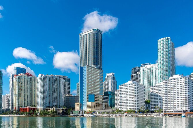
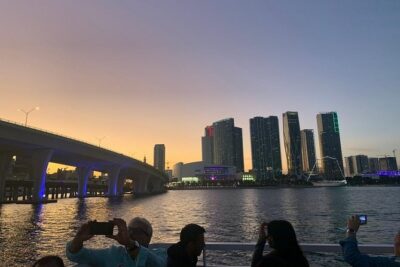
After the port, the route turns toward Miami’s architecture and skyscrapers. From the water, the skyline stretches out differently, and it is easier to spot clusters of buildings that you would miss on land.
The big value here is perspective. Buildings look taller, the bay’s shape becomes part of the scene, and you get sightlines you usually cannot recreate without a rooftop. This is the part of the tour you can show to someone back home and say, “Yes, this is what Miami looks like.”
The tour stays relaxed, and the narration keeps you oriented. You are not spending your whole time craning your neck trying to figure out what you are looking at.
More routes across Biscayne Bay and the skyline
- Miami Combo: City Tour, Biscayne Bay Cruise and Everglades Airboat Ride
★ 3.5 · 2,487 reviews - Miami Biscayne Bay rich and famous Sightseeing Boat Tour
★ 4.5 · 1,998 reviews - Miami: The Original Millionaire’s Row Cruise
★ 4.4 · 1,135 reviews - Miami Skyline Views and Biscayne Bay Cruise
★ 4.5 · 905 reviews - Biscayne Bay and Celebrity Island Homes Boat Tour 90 Minute
★ 4.0 · 486 reviews
Watson Island: A Man-Made Neighborhood With Real Purpose
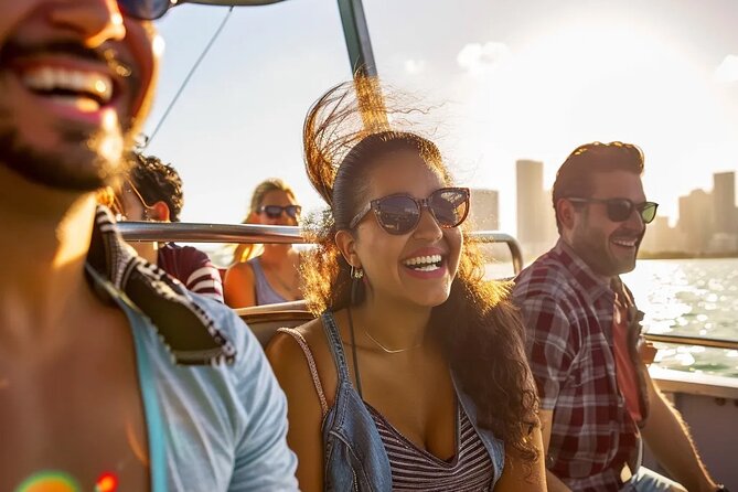
Watson Island is a man-made island in Biscayne Bay. It sits just east of downtown’s business and arts areas and connects to the mainland and South Beach via the MacArthur Causeway.
What makes this stop interesting is that it is not just “another island.” The information you hear is tied to how the island was controlled and used over time. It was deeded to the city in 1919 with restrictions that it be used for public or municipal purposes, and those restrictions carried through state and city transfers in the 1940s.
Even if you do not remember the dates, the takeaway is clear. Miami’s “islands lifestyle” did not appear out of nowhere. It was shaped through planning and development, and those policy decisions still influence how the neighborhood functions today.
If you like to understand what you are seeing instead of just admiring it, this is a strong segment.
Venetian Causeway and the Venetian Islands: How Dredging Shaped Miami
Then you move into the area shaped by the Venetian Causeway. This crosses Biscayne Bay between Miami on the mainland and Miami Beach on a barrier island. The causeway and the Venetian Islands were created using materials taken from dredging the bay.
You also learn the background of the route itself, including that the Venetian Causeway follows the original Collins Bridge route. That bridge, built in 1913, helped open up barrier island growth in a major way.
From the boat, this section works like an open-air map. You can see how the bridges connect and how the islands line up across the bay. It helps you understand why Miami Beach feels like it grew in layers.
If you are hoping for a quick stop where you can get out and walk, you will not get that here. This is a drive-by from the water, with visuals and narration, not a sightseeing detour.
San Marco, Di Lido, and Hibiscus Islands: Celebrity-Home Territory at Boat Speed
As you pass the Venetian Islands sequence, the names start to sound like you are reading the real-estate roll call. San Marco Island sits between Biscayne Island and San Marino Island and is known for upscale houses.
Di Lido Island is on the Miami Beach side of the same chain and is connected to the Venetian Causeway. Hibiscus Island is just north of Palm Island and is described as an exclusive residential neighborhood with relatively high property values.
These are the moments where the “who lives where” vibe shows up. I would not expect a close-up look at every home, but the tour gives you broad, clear views that make the neighborhood layout obvious.
One practical note: if you are shooting photos, keep your camera ready for brief windows of the most open sightlines. The boat moves steadily, and you do not want to miss the cleanest angles.
Flagler Memorial Island: The Obelisk Landmark You Can Actually Spot

One of the easiest landmarks to recognize on this route is Flagler Memorial Island, also described as an uninhabited artificial island of South Beach. The big feature is a 110-foot obelisk with allegorical sculptures at its base.
This monument was built in 1920 to remember Henry M. Flagler, and it was commissioned by Carl G. Fisher. The tour info also mentions the cost at the time of construction, which helps put the scale in perspective.
Why this stop works so well is simple. When you see the obelisk from the water, you get an immediate “this is a real place, not just a coastline” feeling. It is also a reliable orientation point when you look back across the islands.
Palm Island and Star Island: The Exclusive Neighborhoods You Hear About
Palm Island and Star Island appear next, and both are described as high-value residential areas. Palm Island is accessible by land only via the MacArthur Causeway and is described as having high property values.
Star Island is also residential and is associated with a “star-studded” reputation because many homes were once owned by famous celebrities and high-profile individuals.
What you should take from these segments is the contrast between Miami’s public energy and its private waterfront addresses. You are still on a public boat, but the scenery tells a different story.
If you are coming with friends, this is also where your group will start naming places and guessing who might live where. Just remember, these are views from a distance, so manage expectations accordingly.
Fisher Island and the Wider View of South Florida Wealth
Fisher Island is one of the most talked-about names in the area, and the tour’s description gives you key context. It is a barrier island three miles off the mainland, and since 2015 it has the highest per capita income in the United States, according to the tour information.
The island has no road or causeway connection to the mainland, so it is only accessible by private boat, helicopter, or ferry.
From the water, this makes more sense than hearing it in a lecture. The separation from the mainland reads visually right away. It also explains why the place carries such a distinctive reputation.
This is a good stop for anyone who wants Miami without the constant noise. The view feels more controlled, and you can see how the geography supports that exclusivity.
Miami Beach Marina and the Cargo Port: Two Very Different Sides of the Same Bay
Midway through the experience, you get a look connected to the Miami Beach Marina. The details shared include that it is adjacent to Government Cut, and that it has no fixed bridges with deep water. It is also described as having 400 boat slips for vessels up to 250 feet, plus services like fresh water and electricity.
Then the tour moves to the cargo section of the Port of Miami. This part is a reminder that Miami is not only luxury and skyline photos. It is a trade hub too, and seeing the cargo side helps you understand why the bay matters beyond tourism.
That mix is part of the tour’s value. You get glitz and views, yes. But you also get a sense of how the city actually operates along the water.
Price and Value: What $27.99 Buys You on the Bay
At $27.99 per person for about 90 minutes, this is positioned as a budget-friendly way to see the bay without the cost of a long private charter. You are paying for convenience, distance coverage, and narration, not for a big meal or a guided walking route.
What makes the price feel fair is the range of what you see in a short time: Downtown skyline, cruise ships, multiple island neighborhoods, causeways, and both passenger and cargo port areas. That is a lot of “visual inputs” per dollar.
Included in the ticket are scenic views, a professional crew, and safety gear and equipment. Not included are food and drinks (you can buy them), tips and gratuities, and hotel pickup.
If you do not need a fancy add-on meal and you like getting the overview early in your trip, this price makes sense.
Who This Tour Fits Best
This is a smart pick if you want a calm, family-friendly way to see Miami’s waterfront in a single block of time. It is also a good option if you are staying near downtown or South Beach and want something that does not require renting a car for a half-day.
You will get the most out of it if you enjoy the “explain it to me” style of sightseeing. The narration ties the scenery together, and the island naming helps you keep track of where you are.
If you are looking for a hands-on experience, like swimming or getting out to explore each island on foot, this is not that kind of tour. It is a view-first cruise.
Should You Book This Miami Cityscape Boat Tour?
Book it if you want a straightforward, waterfront-heavy introduction to Miami that lasts about 90 minutes and hits skyline, islands, and port scenes in one go. The $27.99 price is reasonable for the amount of water you cover and the variety of settings you see.
Skip it or think twice if you hate any gratuity push and prefer tours where the staff stays hands-off about tips. Also, if you need lots of time to get off the boat and wander, you will likely find the cruise format too limited.
Overall, this is a solid value choice for anyone who wants Miami’s layout to “click” fast, while still enjoying the relaxing ride.
FAQ
How long is the Miami Cityscape Boat Tour?
The tour lasts about 1 hour 30 minutes.
How much does the boat tour cost?
It costs $27.99 per person.
Where do I meet the tour?
You meet at Miami’s Top Water Tours, 401 Biscayne Blvd, Miami, FL 33132. For Pier 5, you head to slips 21-23 behind the Victoria Secret, and check in at the Bayride Tours window on the north side of the pier.
Is food or drinks included?
No. Food and drinks are available for purchase, but they are not included in the ticket price.
Is hotel pickup included?
No. Hotel pickup and drop-off are not included.
Do I need a printed ticket?
No. The tour uses a mobile ticket.
Is the tour suitable for families?
Yes. It is described as family-friendly and suitable for all ages.
Can I bring a service animal?
Yes. Service animals are allowed.
Is alcohol available, and is there an age limit?
Alcoholic beverages are allowed for guests who are 21 years old and above.
What is the cancellation policy?
You can cancel for a full refund up to 24 hours in advance. If you cancel less than 24 hours before the start time, the amount paid is not refunded.
More Biscayne Bay Cruises

More Miami Boat Tours





More Tour Reviews in Miami



Recently added around Miami




Miami Boat Tours & Cruises, compared.
 ★ 4.5Biscayne Bay Millionaire’s Homes Sightseeing CruiseFrom $207,348 reviews
 ★ 4.1Hop-on Hop-off Open-top Bus Tour and Optional CruiseFrom $453,077 reviews
 ★ 4.5Speedboat Sightseeing Adventure of MiamiFrom $453,025 reviews
 ★ 5.02 hrs Miami Private Boat Tour with Cooler, Ice, Bluetooth StereoFrom $652,968 reviews
 ★ 3.5City Half Day Tour of Miami by Bus with Sightseeing CruiseFrom $342,747 reviews
 ★ 3.5Miami Skyline Boat Cruise Past Millionaire’s Homes Optional StopFrom $122,718 reviews
 ★ 3.5Miami Combo: City Tour, Biscayne Bay Cruise and Everglades Airboat RideFrom $692,487 reviews
 ★ 3.5Hop-on Hop-off Tour + Cruise & Free 1-Hour Bike RentalFrom $412,421 reviews
Browse the lists this tour appears in